Examples Example 1 of 4

Example 1 · Ballston, Arlington County, Virginia

Commercial redevelopment on urban fill

The job. A 3.09 acre office pad near Ballston in Arlington County, Virginia, is being redeveloped. The existing site is almost all roof and pavement. The owner wants a little more landscaping and an underground detention vault under the new parking deck. The 10-year, 24-hour storm governs.

About this example

This is a real run on app.curvenumber.com, made under the CurveNumber Examples account. The place is real. The client, the plans and the geotechnical report are fictional, and the run says so wherever they are named.

What this example shows

  • A site where the soil survey gives no soil group at all, and what CurveNumber does about it.
  • A “no headline yet” run that is saved and never charged.
  • Answering the soil question from a geotechnical report, with a written reason.
  • Editing the proposed areas, and a curve number read straight out of TR-55.
  • Overriding a curve number, and how the report flags a large change.
  • Routing the proposed runoff through an underground vault with an orifice.
  • Publishing a fixed link for the plan reviewer.

01Create the project and the site

On the Workspace, open + New project, name it, and add the client and jurisdiction. Then press + New site inside the project.
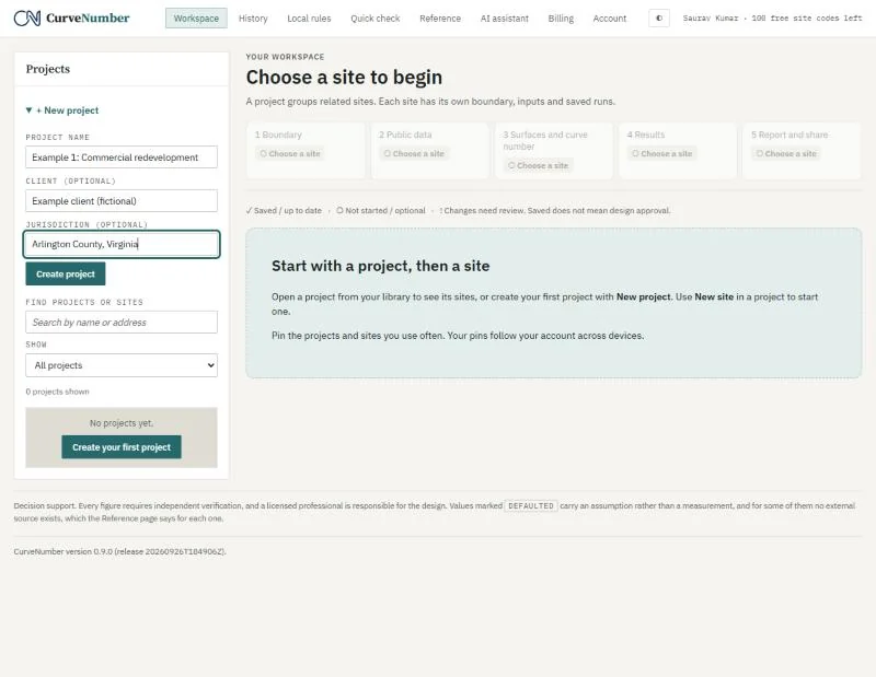
The Workspace with the new project form open on the left: project name Example 1: Commercial redevelopment, client Example client (fictional), jurisdiction Arlington County, Virginia, and a Create project button. The main panel reads Choose a site to begin.
A new project. Name, client and jurisdiction; the client is marked fictional.
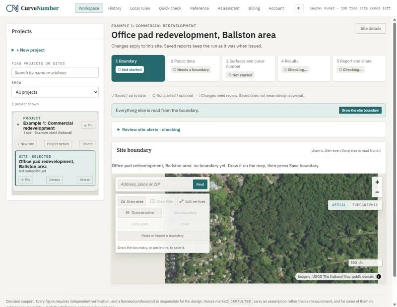
The site Office pad redevelopment, Ballston area, with the five step tabs across the top and Boundary selected. Below, an aerial photograph with the drawing tools: draw area, draw hole, edit vertices, and paste or import a boundary.
The new site, at the Boundary step. The five steps run across the top; only the first is started.

02Draw or paste the boundary

Draw the area on the aerial photograph, or use Paste or import a boundary to paste GeoJSON, WKT or KML, or to load a .geojson, .kml or .wkt file. CurveNumber shows the enclosed area (here 3.094 acres). Press Save boundary to keep it.
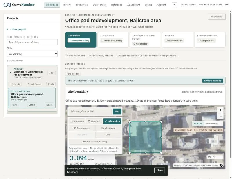
A four sided boundary drawn over the aerial photograph of an office building in Ballston. A readout shows 3.094 acres and 134,791 square feet enclosed, and a message says the boundary is placed on the map at 3.09 acres: check it, then press Save boundary.
The boundary placed. The enclosed area, 3.094 acres, shows while you draw; it is not saved yet.
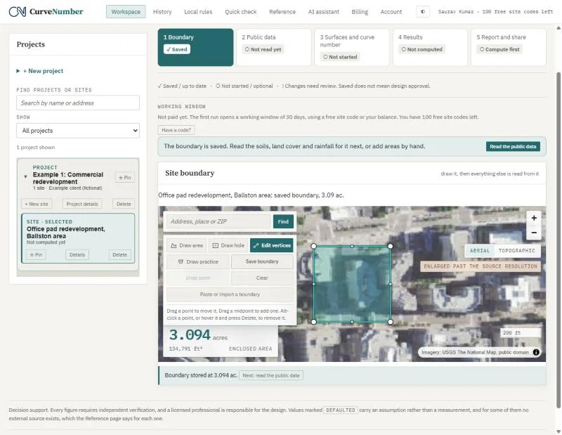
The Boundary step marked Saved. A bar reads: the boundary is saved, read the soils, land cover and rainfall for it next, with a Read the public data button. The map shows the saved boundary at 3.094 acres.
The boundary saved. Boundary step marked saved, and the next action is to read the public data.

03Read the public data

Press Read the public data. CurveNumber asks four public services at once: the USDA soil survey (SSURGO), the national land cover map (NLCD), the USGS elevation model (3DEP), and NOAA Atlas 14 rainfall. A slow service does not hold up the others.

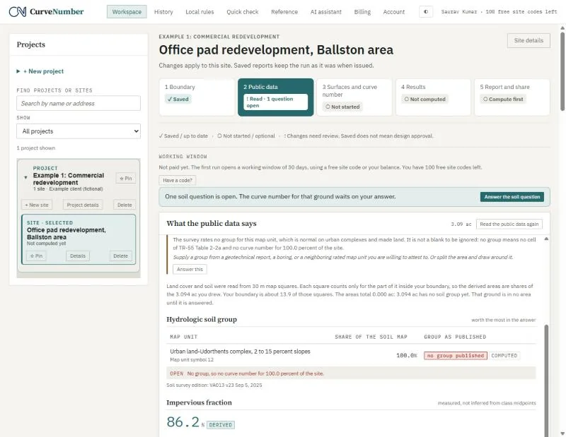
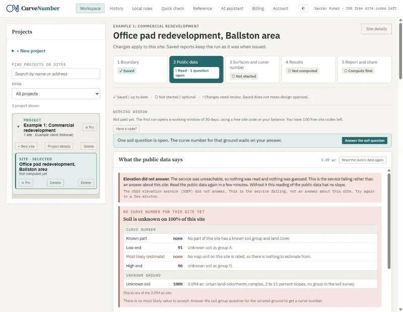
Here the soil survey maps the whole site as Urban land-Udorthents complex, a map unit with no hydrologic soil group. That is normal for old urban fill, but it means TR-55 has no curve number for 100 percent of the site. CurveNumber does not guess. It shows the range instead: CN 91 if the ground behaves like group A, up to CN 96 if it behaves like group D, and asks you one question.

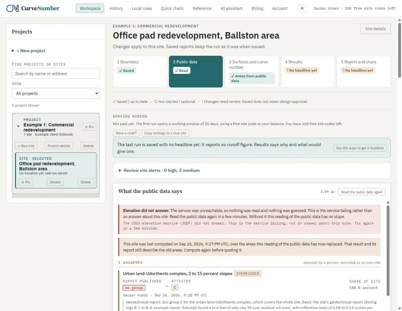
It also says plainly when a service fails. On the day of this example the USGS elevation service did not answer, so the page says so and reads no slope, rather than inventing one. We entered the time of concentration by hand instead.

The rainfall table gives the NOAA Atlas 14 24-hour depths at the site, from 1-year to 100-year. We used the 10-year depth, 4.85 inches.
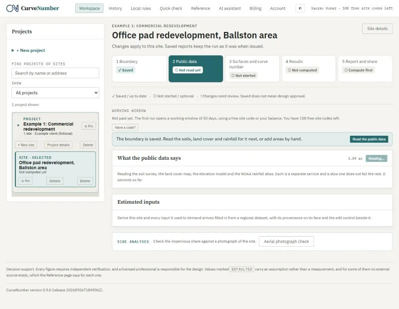
The Public data step while it reads: a panel says it is reading the soil survey, the land cover map, the elevation model and the NOAA rainfall atlas, each a separate service, so a slow one does not fail the rest.
Reading the public data. Four services, each read on its own.
A red panel headed No curve number for this site yet: soil is unknown on 100 percent of this site. A table gives the low end as 91 with the soil taken as group A and the high end as 96 as group D. Above it, a note that the elevation service did not answer and nothing was guessed.
No curve number for this site yet. Soil is unknown on 100 percent of the site; the range runs from CN 91 to CN 96.
The open soil question: which hydrologic soil group applies to Urban land-Udorthents complex, 2 to 15 percent slopes. The soil table lists the map unit at 100 percent of the site with no group published.
The one open question. Which hydrologic soil group applies to the urban fill.

04A run with “no headline yet”

You can compute before answering the soil question. CurveNumber saves the run, does not charge for it, and leads with the ways to get a headline number:

  • Enter your soil group from a boring or geotechnical report.
  • Waive and name the group yourself.

It also shows what the answer would be either way: between 4.06 and 4.41 inches of runoff at 4.85 inches of rain. A blank is never shown as a zero.
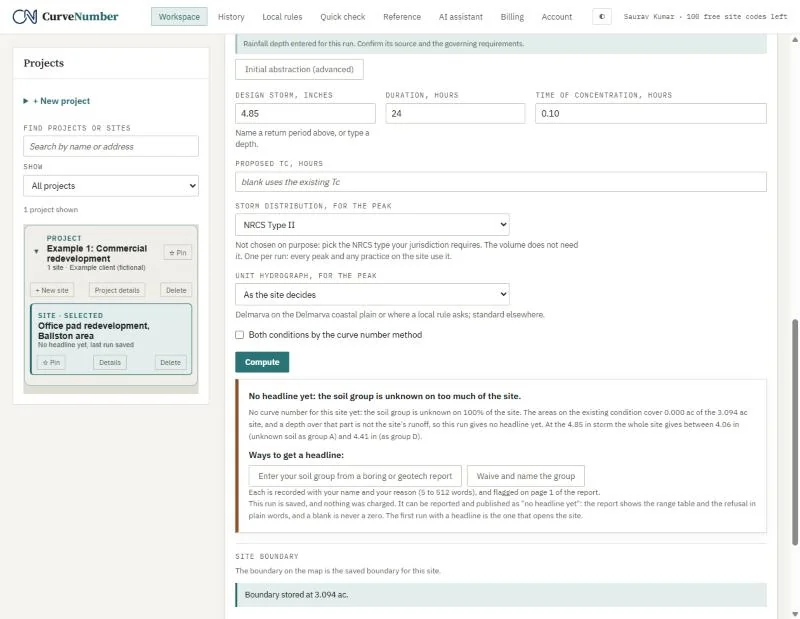
Below the Compute button, a panel headed No headline yet: the soil group is unknown on too much of the site. It gives the range of runoff either way and two buttons under Ways to get a headline: enter your soil group from a boring or geotech report, and waive and name the group.
No headline yet. The run is saved and not charged, and the page lists the ways to get a headline.

05Answer the soil question from the geotechnical report

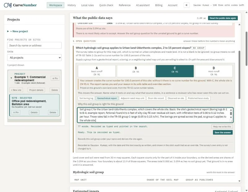
Pick the group (we chose C), say where it comes from (Geotechnical report), and write the reason. Every reason box takes 5 to 512 words and shows the count as you type.

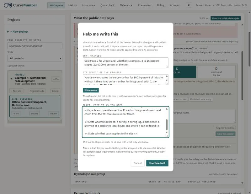
Help me write this opens a first draft from the change and its effect. You edit it and confirm it; nothing is accepted until you do, and the report says when a reason began as a draft.

Our reason: the fictional geotechnical report found silty clay fill with infiltration rates of 0.08 to 0.12 inches per hour, which is within the TR-55 group C range of 0.05 to 0.15 inches per hour.
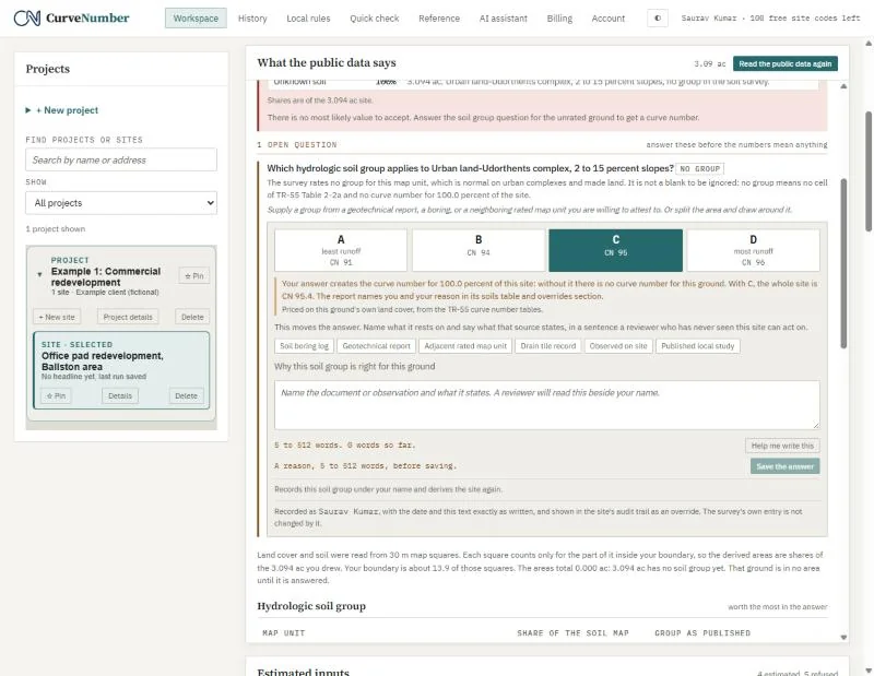
The soil question with four buttons for groups A, B, C and D; C is selected at CN 95. Below, what the answer moves, a row of source buttons such as soil boring log and geotechnical report, and an empty reason box.
Group C chosen. The page states what the answer moves before you save it.
The Help me write this dialog: what changes, its effect on the figures, and a draft with gaps marked to fill in, such as state what this rests on. A note says this is a draft for you to edit and nothing in it is accepted until you accept it.
A first draft to edit. CurveNumber's own outline, with gaps for you to fill; nothing is accepted until you confirm it.
The reason box filled in: soil group C for the urban fill, based on the site's geotechnical report, borings B-1 to B-4, with infiltration tests of 0.08 to 0.12 inches per hour. A counter reads 77 words, and a Save the answer button.
The reason, ready to save. 77 words, recorded as typed and printed in the report.
The Public data step now marked Read, and the soil question listed under Answered: Urban land-Udorthents complex, marked overridden, survey published no group, attested C, 100 percent of the site, with the reason beneath it.
The question answered. The answer is recorded as an override, with the name and time.

06Existing and proposed areas

With the soil group known, CurveNumber builds the existing condition from the measured land cover: 2.666 acres of pavement and roof (CN 98) and 0.428 acres of open space in fair condition on group C (CN 79).

Copy the existing areas into the proposed condition, then edit what changes:

  • The paved and roofed area drops to 2.200 acres, with a reason citing the site plan.
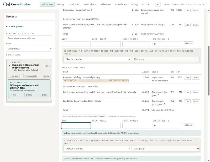
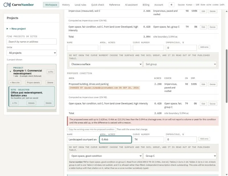
  • A new 0.466 acre landscaped courtyard is added by choosing the surface (Open space, good condition) and the soil group (C). CurveNumber reads CN 74 straight out of TR-55 Table 2-2a and cites it.

If the areas do not add up to the site, CurveNumber says so in red and will not report a volume or peak until they do.
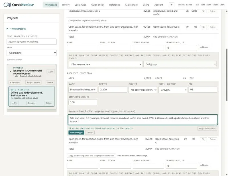
The proposed condition with one area open for editing: Proposed building, drives and parking, 2.200 acres, group C, CN 98, 100 percent impervious. The reason cites site plan sheet C-3 (example, fictional).
Editing a proposed area. The paved and roofed area drops to 2.200 acres, with a reason citing the site plan.
Adding a landscaped courtyard of 0.466 acres by choosing Open space, good condition and Group C. A note says curve number 74 comes from USDA NRCS TR-55 Tables 2-2a to 2-2d. Above, a red line says the proposed areas add up to less than the drainage area.
CN 74, read out of TR-55. Choose the surface and the soil group, and the table supplies the curve number and its citation.
The proposed condition list: proposed building, drives and parking, 2.200 acres at CN 98; open space in fair condition, 0.428 acres at CN 79; landscaped courtyard and tree islands, 0.466 acres at CN 74; total 3.094 acres.
The proposed areas. The areas add up to the site, 3.094 acres.

07Override a curve number, with a reason

The strip that stays as a construction staging area will be heavily compacted. We changed its curve number from 79 to 86 and said why: compacted fill behaves like group D, and TR-55 gives CN 84 for fair open space on group D. We used 86 to allow for gravel patches.

A change of 5 curve number points or more is marked large on the report, next to every figure it affects.
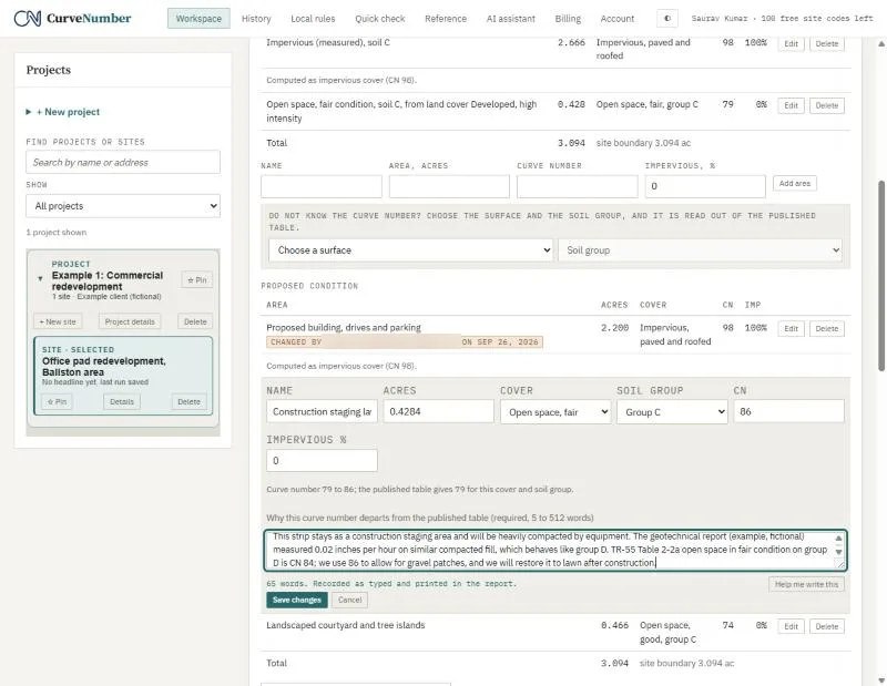
Editing the construction staging area: 0.4284 acres, open space in fair condition, group C, curve number 86. A line reads curve number 79 to 86, the published table gives 79 for this cover and soil group, and the reason box explains the compaction and the gravel patches.
An override, with its reason. Curve number 79 to 86 on the staging area.

08Compute

Choose the storm distribution your jurisdiction requires (here NRCS Type II) and press Compute. The first run with a headline uses one free site code and opens a 30-day working window.

Curve numberRunoff depthRunoff volumePeak
Existing95.44.345 in48,803 cu ft18.12 cfs
Proposed92.74.079 in45,814 cu ft17.24 cfs

CurveNumber computes runoff area by area on each area's own curve number and adds them up, rather than averaging the curve numbers first. We checked the depths by hand with the TR-55 runoff equation; they match to the last digit.
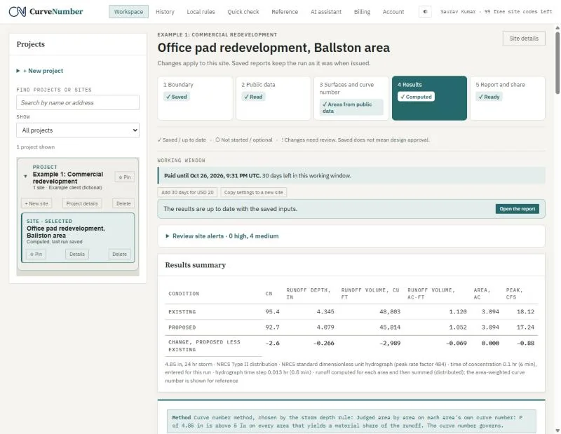
The Results step, computed. The results summary table lists existing CN 95.4, runoff depth 4.345 inches, 48,803 cubic feet, peak 18.12 cfs; proposed CN 92.7, 4.079 inches, 45,814 cubic feet, 17.24 cfs; and the change, proposed less existing.
The results summary. Existing and proposed, with the change between them.

09Add the underground vault

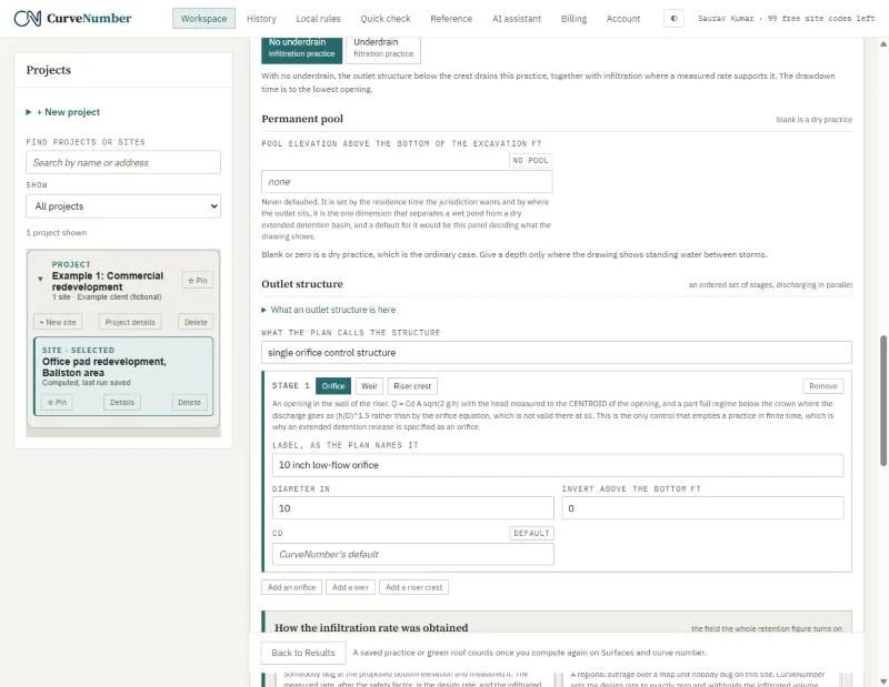
Open Practices and green roof from Results. Choose the kind (underground detention vault), give the footprint (2,000 square feet), and add the outlet: a single 10-inch orifice at the bottom. Mark the vault as lined, so no infiltration is claimed.

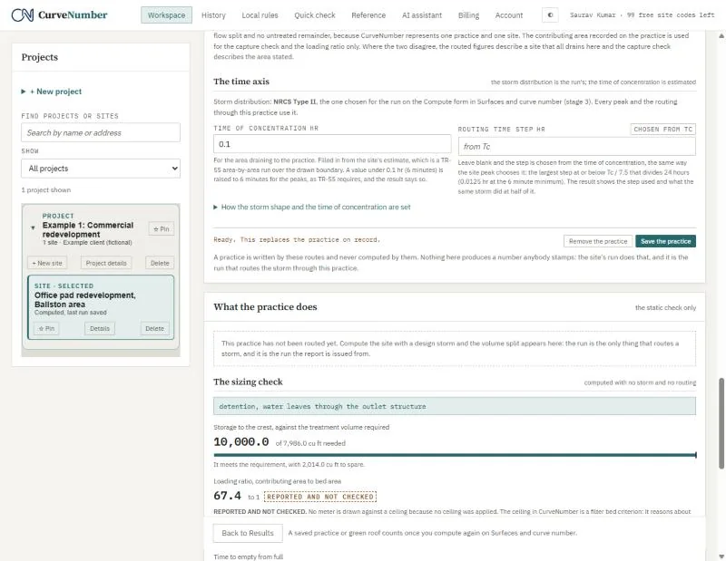
The sizing check shows 10,000 cubic feet of storage against the treatment volume needed.

Adding a practice changes the site, so CurveNumber asks you to acknowledge that the last run no longer describes it, and to give a reason. Then compute again.
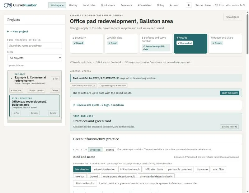
The Practices and green roof side analysis, with a row of practice kinds: bioretention, micro-bioretention, infiltration trench, infiltration basin, permeable pavement, dry swale, sand filter, tree box, drywell, underground detention vault and dry extended detention basin.
Practices and green roof. Choose the kind of practice.
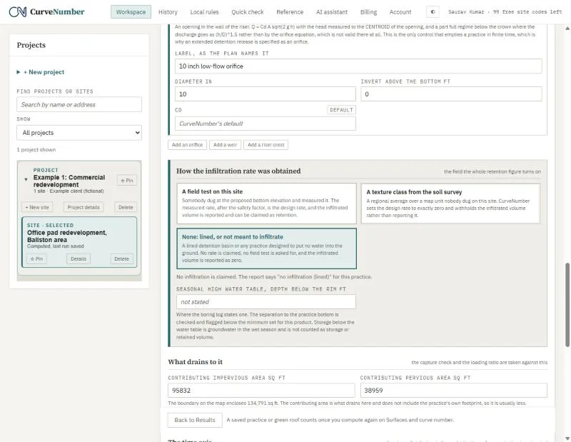
The outlet structure form: stage 1 is an orifice, labeled 10 inch low-flow orifice, diameter 10 inches, invert 0 feet above the bottom, with the discharge coefficient left at CurveNumber's default.
The outlet. One stage: a 10-inch low-flow orifice at the bottom.
A choice headed How the infiltration rate was obtained, with three options: a field test on this site, a texture class from the soil survey, and None: lined, or not meant to infiltrate, which is selected.
Lined, so no infiltration is claimed. How the infiltration rate was obtained: none, lined.
The sizing check for the vault: detention, water leaves through the outlet structure. Storage to the crest against the treatment volume required reads 10,000.0 cubic feet, which meets the requirement.
The sizing check. 10,000 cubic feet of storage against the volume needed.

10Results with the vault

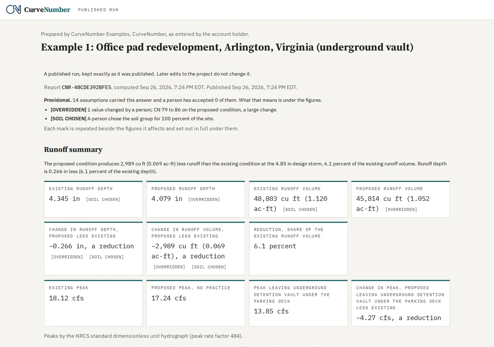
The proposed peak leaving the vault is 13.85 cfs, down from 18.12 cfs existing and 17.24 cfs with no practice. CurveNumber also reports that in this storm the vault overflowed: 2,342 cubic feet, 5.1 percent of what reached it, went over the crest untreated. It says so on Results and on page 1 of the report, so the reviewer sees it too.
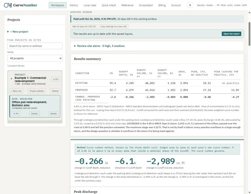
The results summary with a new column, peak leaving the practice: 13.85 cfs proposed. Below the table a paragraph says the vault was exceeded in the 4.85 inch storm, with 2,342 cubic feet, 5.1 percent of the inflow, passing over the crest untreated.
Results with the vault. Peak leaving the practice 13.85 cfs, and the overflow stated in words.

11The report and the published link

Open the report gives the printable report. It starts with a short reviewer summary:

  • page 1: the headline figures and what they rest on;
  • page 2: what was entered;
  • page 3: every change a person made, with its reason.

The full record follows. Print it with your browser's Print, then Save as PDF.

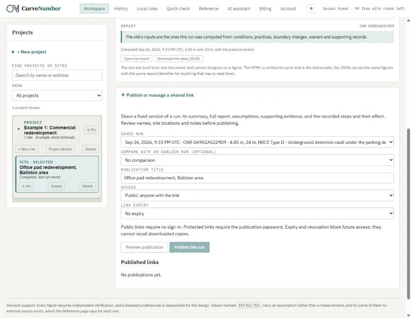
Publish a run makes a fixed, read-only link for the reviewer. A published link never changes: if you publish again, you get a new link, and the old page says a newer version exists. Every printed page carries the report id and the published address.
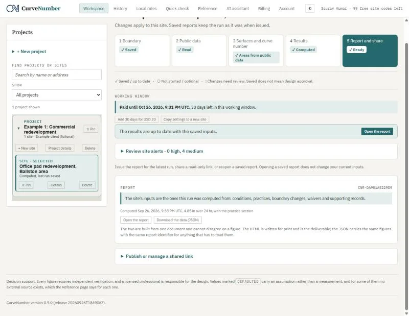
The Report and share step, marked Ready. The report card shows the report identifier with buttons to open the report and download the data as JSON, and a closed section headed Publish or manage a shared link.
Report and share. Open the report, download the data, or publish a shared link.
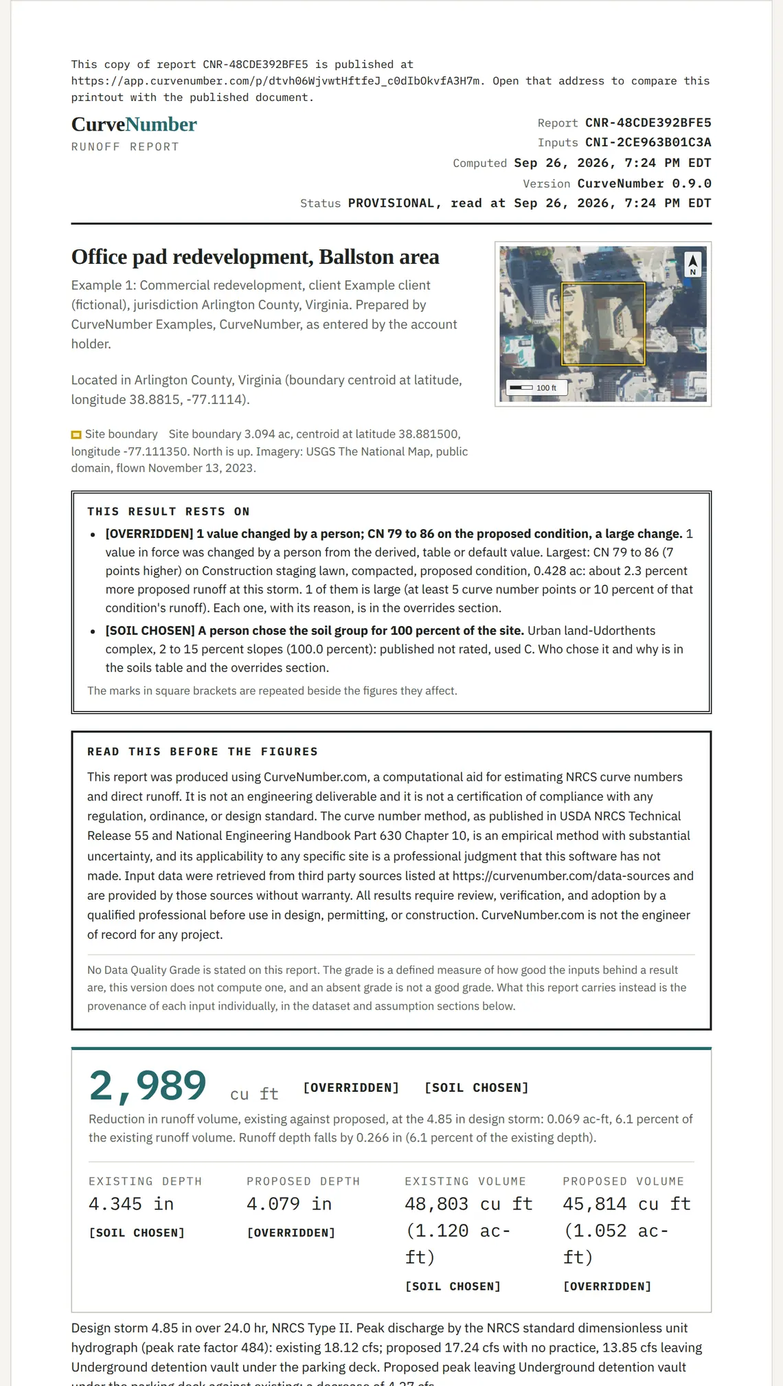
Page 1 of the printed report: the published address and report identifier, the site name Office pad redevelopment, Ballston area, a site map with the boundary over aerial imagery, the section This result rests on listing the curve number override from 79 to 86 and the chosen soil group, and the headline reduction of 2,989 cubic feet.
Page 1 of the report. The headline figures and what they rest on.
The Publish or manage a shared link form: the saved run to publish, an optional earlier run to compare with, the publication title Office pad redevelopment, Ballston area, access public to anyone with the link, no expiry, and Preview publication and Publish this run buttons.
The publish form. Choose the run, the title, the access and the expiry.
The top of the published page for Example 1: Office pad redevelopment, Arlington, Virginia (underground vault). It gives the report identifier, the marks for the overridden curve number and the chosen soil group, and cards for the runoff depths, volumes and peaks, including the peak leaving the vault of 13.85 cfs.
The published page. What the plan reviewer opens.

The published example

A fixed, read-only page with the full report, exactly as it was published. It needs no account.

https://app.curvenumber.com/p/dtvh06WjvwtHftfeJ_c0dIbOkvfA3H7m

Open the published example

All examples