Examples Example 2 of 4
Example 2 · Chatham County, North Carolina
Residential subdivision in the woods, with bioretention
The job. A 12.25 acre wooded tract in Chatham County, North Carolina, becomes a subdivision of half-acre lots with curbed streets. Part of the woods stays. The design checks the 2-year, 24-hour storm and a bioretention area at the low corner.
About this example
This is a real run on app.curvenumber.com, made under the CurveNumber Examples account. The place is real. The developer, the plans and the geotechnical work are fictional, and the run says so wherever they are named.
What this example shows
- Woods on the existing side, and land cover classes too small to keep apart.
- Residential lots whose curve number already includes their roofs and driveways, and the guard that stops you counting them twice.
- CurveNumber's own time of concentration estimate, for both conditions.
- A bioretention area with a field infiltration test and a water table depth.
- A sizing check that refuses to pass a practice that is too small for what drains to it.
- A published link whose report carries a site map.
01The boundary and the public data
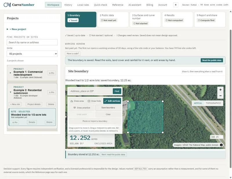
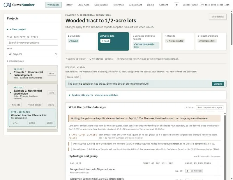
We drew the 12.252 acre tract on the aerial photograph and read the public data. The soil survey puts the whole site in hydrologic group B. The land cover map sees mostly forest, with a few classes smaller than one 30 m map square; CurveNumber folds each of those into the largest class on the same soil and says so in plain words, so nothing is lost without a note.
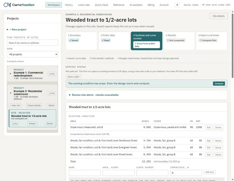
The existing condition is woods in fair condition on group B, CN 60.
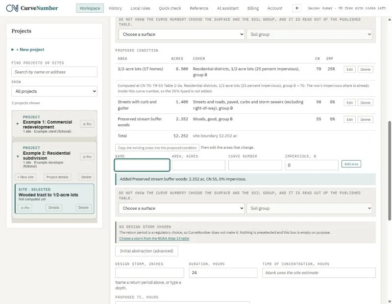
02The proposed lots, streets and woods
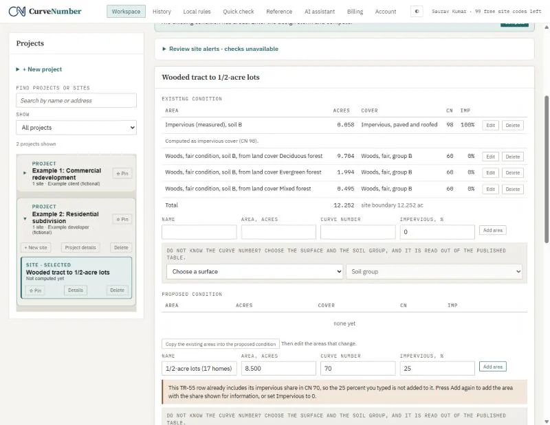
We entered three proposed areas:
| Area | Acres | Curve number |
|---|---|---|
| Half-acre lots (TR-55: 25 percent impervious) | 8.500 | 70 |
| Streets, paved, curbs and storm sewers | 1.400 | 98 |
| Woods kept, good condition | 2.352 | 55 |
When we tried to add the lots' roofs and driveways as a separate impervious area, CurveNumber stopped us: the TR-55 residential curve number already includes the 25 percent impervious cover, so adding it again would count it twice.
03Time of concentration
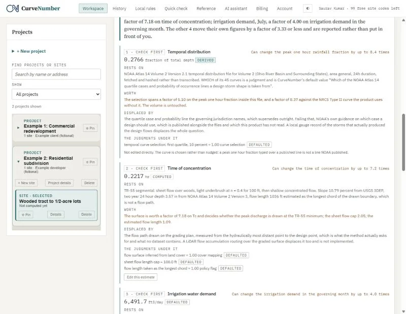
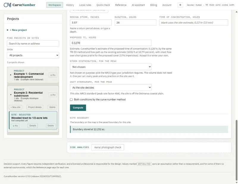
The elevation model gives a slope and a flow path, and CurveNumber estimates the time of concentration by the TR-55 segmental method. For the proposed condition it offers its own estimate on the same flow path with the new cover, labeled an estimate, and you can accept it or type your own.
04Results at the 2-year storm
At 3.57 inches of rain (NOAA Atlas 14, 2-year, 24-hour, NRCS Type II):
| Runoff depth | Peak | |
|---|---|---|
| Existing woods | 0.575 in | 7.17 cfs |
| Proposed subdivision | 1.182 in | 18.79 cfs |
Runoff roughly doubles, and the peak rises by about 2.6 times. We checked both depths by hand with the TR-55 runoff equation.
05Bioretention, with a field test
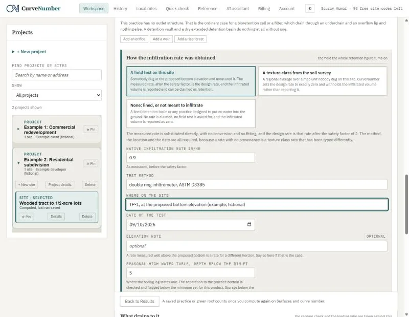
Under Practices and green roof we added a 9,000 square foot bioretention area and entered what the geotechnical work found (fictional, for this example): a double-ring infiltrometer test at TP-1 on September 10, 2026, measuring 0.9 inches per hour, and a seasonal high water table 5 feet below the rim. A measured rate carries its method, location and date onto the report; a rate with no test behind it is marked as an assumption.
06When the practice is too small
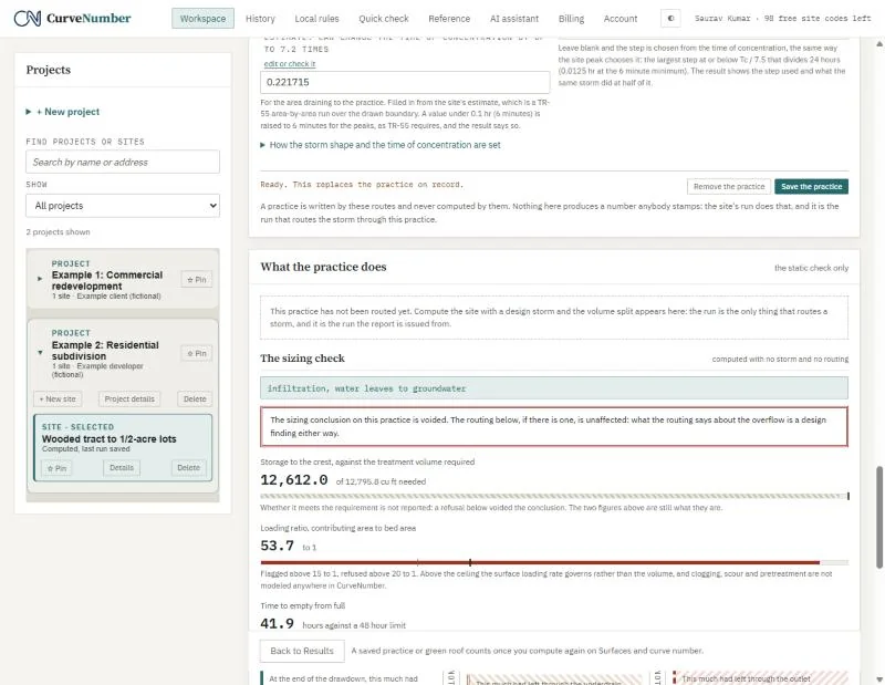
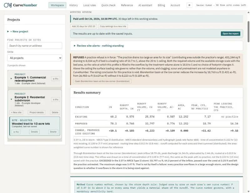
The sizing check compares the area draining to the bioretention with its footprint. Here the ratio is 53.7 to 1, and the design guidance CurveNumber holds sets a ceiling of 20 to 1. CurveNumber does not pass it quietly: it says the loading ratio is exceeded and voids the sizing conclusion, while still computing what the practice would do.
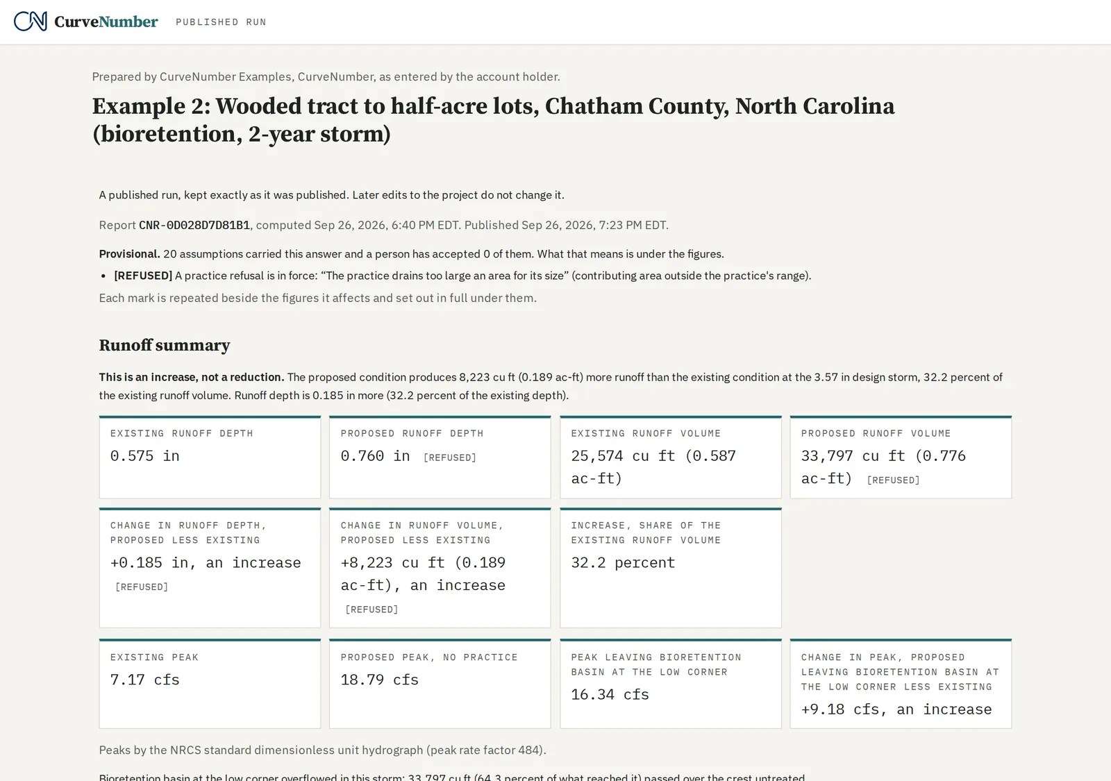
With the bioretention in place, proposed runoff falls to 0.760 inches (about 18,760 cubic feet soaked into the ground), and the peak leaving the site falls to 16.34 cfs. The report also says that 64.3 percent of the water reaching the practice went over the overflow untreated. That is the point of the example: the numbers show a practice working hard and still too small, which is what a reviewer needs to see.
07The published report, with a map
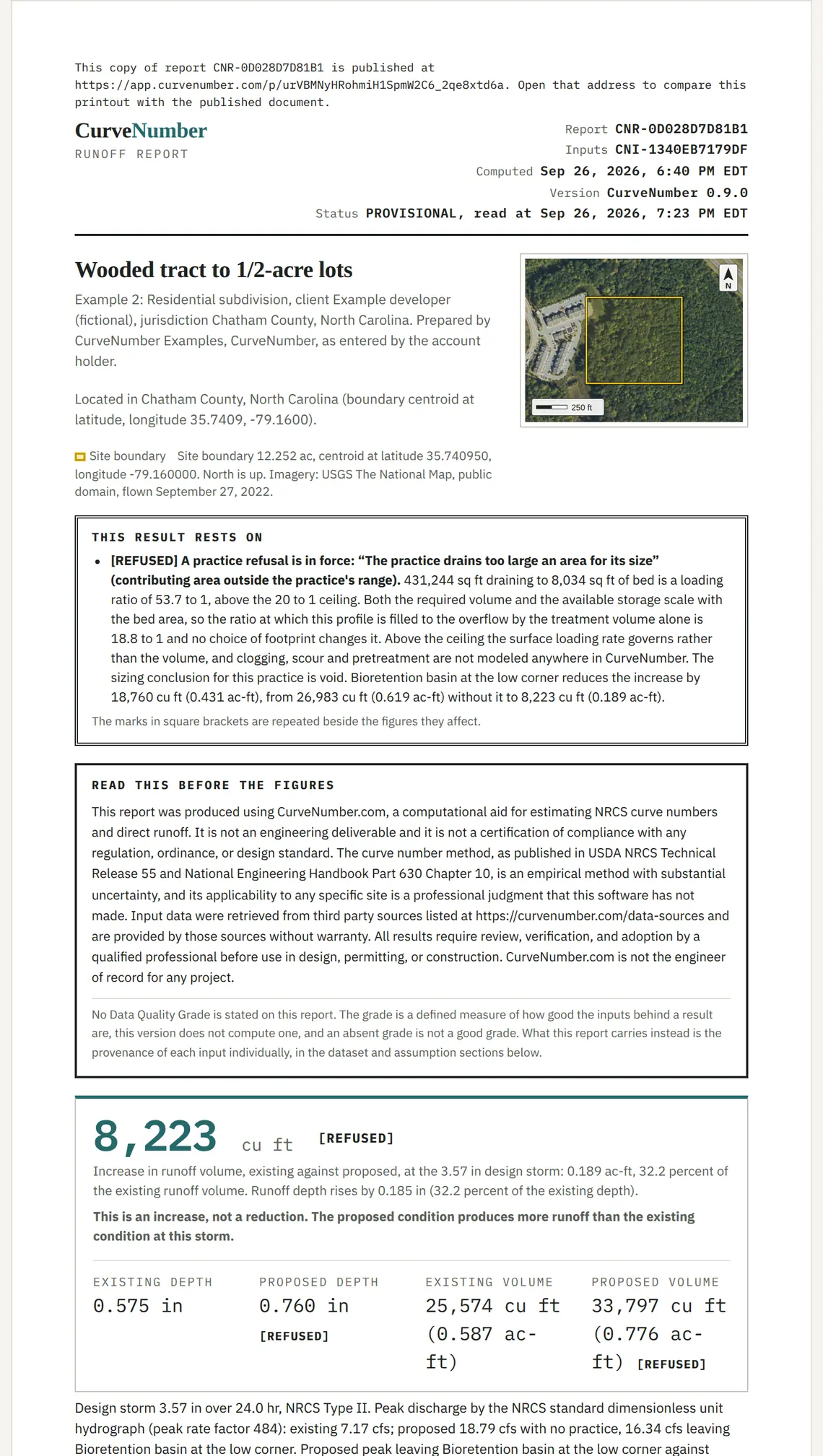
The published page and the printed report carry a site map on page 1: the boundary over aerial imagery, with a north arrow and a scale bar. The map is embedded in the report, so a published link keeps the map it was issued with.
The published example
A fixed, read-only page with the full report, exactly as it was published. It needs no account.
https://app.curvenumber.com/p/urVBMNyHRohmiH1SpmW2C6_2qe8xtd6a